PowerPoint Presentation
Scene 1 (0s)
[Audio] This presentation is about the proposed project for Calbiga bypass road.
Scene 2 (20s)
[Audio] INTRODUCTION,. INTRODUCTION.
Scene 3 (25s)
[Audio] WHY BUILD A BYPASS ROAD? Highways are often the main street in small and medium-sized communities. This means they serve local as well as regional, travel. Hence the existing route along Daang Maharlika Highway in Calbiga Samar is a National road. Trucks and other fast-moving traffic can cause primary danger to the community when it comes into conflict with slow-moving local traffic, bicyclist, pedestrian, and other people walking or living on the roadside. In this situation, the bypass would significantly reduce the said danger, provide alternate routes for vehicles and improve road safety in this community. ,.
Scene 4 (1m 8s)
[Audio] PROJECT DESCRIPTION,. PROJECT DESCRIPTION.
Scene 5 (1m 13s)
[Audio] The following proposed details of the project are as follows Name of the proposed project is calbiga bypass road, location of the project is on calbiga samar, the proposed appropriation is eight hundred forty million pesos, the target road length in terms of kilometer is six kilometers, the road carriageway width in meters per lane is 3.05 meters, the number of lanes is 4 lanes, the road shoulder width in terms of meter is 1.5 to 2 meters bothsides and other details incorporated into the projects are slope protections, drainages, cross drains and bridge.,.
Scene 6 (1m 49s)
[Audio] PROJECT OBJECTIVES,. PROJECT OBJECTIVES.
Scene 7 (1m 55s)
[Audio] Project objectives are summarized as follows FIRST TO LET THROUGH TRAFFIC FLOW WITHOUT INTERFERENCE FROM LOCAL TRAFFIC, SECOND TO REDUCE CONGESTION IN THE BUILT-UP AREA, THIRD TO IMPROVE ROAD SAFETY AND LASTLY TO PROVIDE MOTORISTS A FASTER ROUTE FOR TRAVELING,.
Scene 8 (2m 15s)
[Audio] PROJECT LOCATION,. PROJECT LOCATION.
Scene 9 (2m 21s)
[Audio] This is the project location map of the proposed calbiga bypass road, the yellow line is the proposed project which starts at the station K0845+ 780 and ends at station K0851+ 214, while the red line indicates the existing route or road along daang Maharlika which is the national road.,.
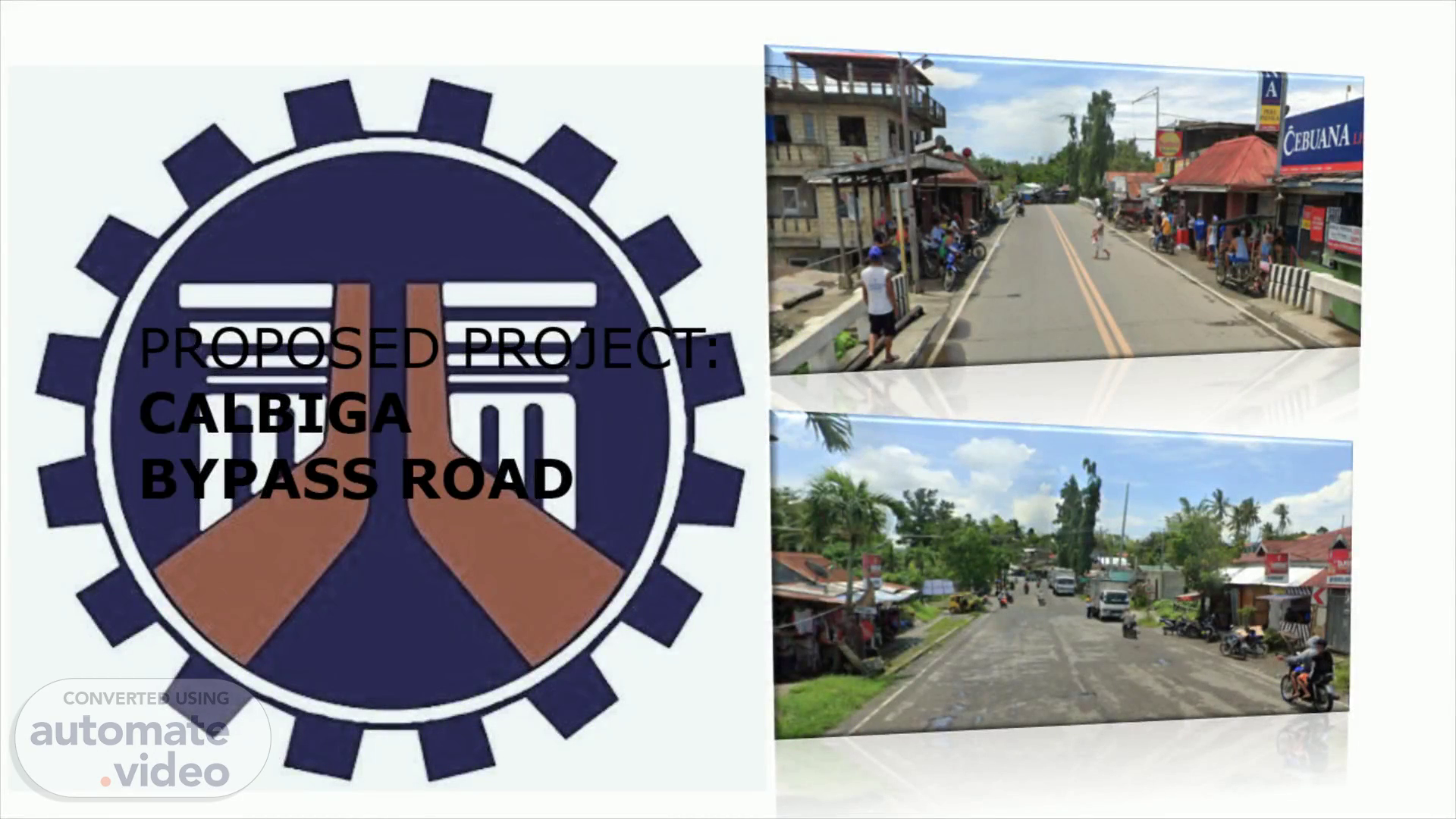
Scene 10 (2m 42s)
[Audio] GEOTAGGED PICTURE OF LOCATION,. GEOTAGGED PICTURE OF LOCATION.
Scene 11 (2m 48s)
[Audio] This are the geotagged photos of the start and end location of the proposed project.,.